Introduction
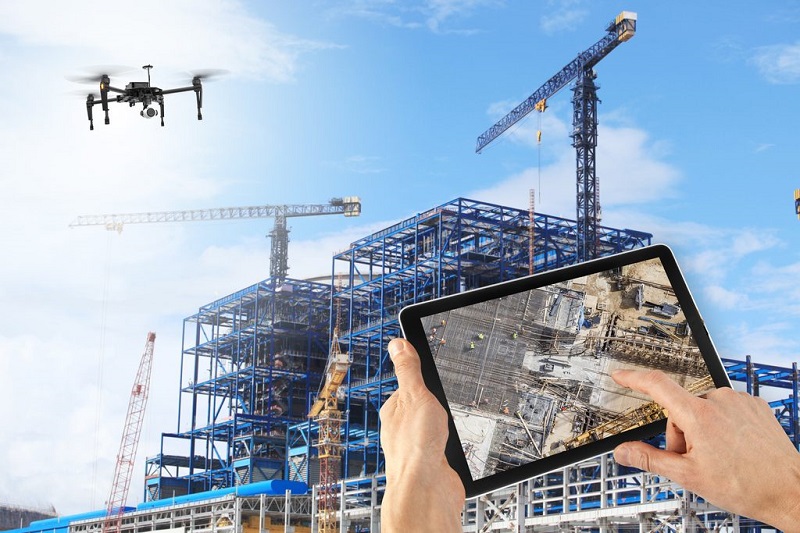
In recent years, drones have revolutionized various industries, including agriculture, entertainment, and logistics. However, one of the most significant impacts of drone technology has been in the field of architecture. Drones, or Unmanned Aerial Vehicles (UAVs), have transformed architectural surveying and design, offering unprecedented capabilities in data collection, site analysis, and project visualization. This article explores the principles, benefits, challenges, and future prospects of using drones in architecture, with case studies demonstrating successful implementations.
Principles of Drone Technology in Architecture
- Aerial Photography and Videography: Drones equipped with high-resolution cameras capture detailed images and videos from various angles and heights. This provides architects with a comprehensive view of sites and structures.
- Photogrammetry and 3D Mapping: Photogrammetry involves using drone-captured images to create accurate 3D models of landscapes, buildings, and other structures. This technique is essential for precise measurements and site analysis.
- LiDAR (Light Detection and Ranging): LiDAR sensors on drones emit laser pulses to measure distances and generate high-resolution 3D models. This technology is particularly useful for mapping complex terrains and densely vegetated areas.
- Thermal Imaging: Drones equipped with thermal cameras detect heat variations in buildings and landscapes. This helps identify issues such as heat leaks, insulation problems, and water damage.
- Remote Sensing: Drones collect various types of data, including topographic, environmental, and structural information. This data is crucial for site analysis, environmental impact assessments, and planning.
Benefits of Using Drones in Architecture
- Enhanced Data Collection: Drones provide high-quality, real-time data that is more accurate and comprehensive than traditional surveying methods. This improves the precision of site analysis and project planning.
- Time and Cost Efficiency: Drone surveys are faster and more cost-effective than manual surveys. They reduce the need for extensive on-site labor and equipment, leading to significant savings in time and resources.
- Improved Safety: Drones can access hard-to-reach or hazardous areas without putting human surveyors at risk. This enhances safety during site inspections and data collection.
- Detailed Documentation: Drones capture detailed visual and spatial data that can be used for documentation, monitoring, and historical records. This is valuable for project tracking and future reference.
- Enhanced Visualization: High-resolution aerial images and 3D models generated by drones provide architects with detailed visualizations of sites and structures. This aids in design conceptualization, client presentations, and stakeholder communication.
- Sustainable Practices: Drones reduce the environmental impact of surveying by minimizing the need for ground-based transportation and heavy machinery. This aligns with sustainable and eco-friendly practices in architecture.
Challenges and Solutions
- Regulatory Compliance: Drone operations are subject to regulations and restrictions, including airspace rules and privacy concerns. Architects must ensure compliance with local and national regulations to avoid legal issues. Solution: Stay informed about drone regulations, obtain necessary permits, and work with certified drone operators who understand compliance requirements.
- Technical Limitations: Drones have limitations in battery life, payload capacity, and weather resistance. These factors can affect their performance and data collection capabilities. Solution: Use drones with advanced battery technology, weather-resistant features, and modular designs that allow for payload customization. Plan flights strategically to maximize efficiency.
- Data Management: The large volume of data collected by drones can be challenging to process, store, and analyze. Efficient data management is crucial for deriving actionable insights. Solution: Utilize cloud-based platforms and advanced software tools for data processing, storage, and analysis. Employ data specialists to manage and interpret drone data effectively.
- Privacy Concerns: The use of drones for aerial surveillance raises privacy concerns, particularly in populated areas. Ensuring ethical use of drone technology is essential. Solution: Implement privacy policies, obtain consent from property owners, and use drones responsibly to respect privacy and avoid intrusive data collection.
- Skill and Training: Operating drones and interpreting the data they collect requires specialized skills and training. Architects and surveyors must be proficient in drone technology and data analysis. Solution: Invest in training programs for staff, collaborate with drone specialists, and stay updated on the latest advancements in drone technology and applications.
Case Studies and Successful Implementations
- ScanLAB Projects, UK: ScanLAB Projects uses drones equipped with LiDAR and photogrammetry to create detailed 3D models of historic buildings and landscapes. Their work includes documenting heritage sites and assisting in restoration projects.
- Foster + Partners, USA: The architectural firm Foster + Partners employs drones for site analysis and project visualization. Drones have been used in projects like the Apple Park campus, providing valuable aerial data for design and construction.
- Höweler + Yoon, USA: The architecture firm Höweler + Yoon uses drones for urban planning and environmental analysis. Their drone surveys have informed the design of public spaces and infrastructure projects.
- Liftaer, Sweden: Liftaer specializes in drone-based inspections and surveys for construction and architecture. Their drones provide real-time data for monitoring construction progress and assessing structural integrity.
- SLAM Collaborative, USA: SLAM Collaborative utilizes drones for site surveys, environmental impact assessments, and 3D modeling. Their drone technology has enhanced the accuracy and efficiency of their architectural projects.
Future Prospects
- Integration with BIM: Drones will increasingly integrate with Building Information Modeling (BIM) systems, providing real-time data for dynamic and interactive project management. This integration will enhance collaboration and streamline workflows.
- Autonomous Drones: Advances in artificial intelligence and machine learning will lead to the development of autonomous drones capable of performing complex tasks with minimal human intervention. This will further increase efficiency and data accuracy.
- Enhanced Sensors and Capabilities: Future drones will feature enhanced sensors, including multispectral and hyperspectral imaging, to provide even more detailed and diverse data. These capabilities will expand the applications of drones in architecture.
- Urban Air Mobility: Drones will play a significant role in the development of urban air mobility solutions, such as drone taxis and delivery services. This will influence urban planning and the design of transportation infrastructure.
- Sustainable Urban Development: Drones will contribute to sustainable urban development by providing data for green building practices, energy efficiency assessments, and environmental monitoring. This aligns with the growing emphasis on sustainability in architecture.
Conclusion
The integration of drones into modern architectural surveying and design represents a paradigm shift in how architects approach site analysis, data collection, and project visualization. Drones offer numerous benefits, including enhanced data accuracy, cost efficiency, improved safety, and sustainable practices. While challenges such as regulatory compliance, technical limitations, and data management exist, solutions are readily available to address these issues. As technology continues to advance, drones will play an increasingly vital role in shaping the future of architecture, driving innovation, and promoting sustainable urban development.
For further information, check these sources:
If you have any questions or need more articles, feel free to ask!